Exploration log0/26
—
Start exploring
43°41′N · 2°53′E

Interactive cultural maps & directories

Only 1% of art is visible. Go explore the rest.

We create interactive cultural maps and directories of artists, venues and works for territories, festivals and networks.

26 places5 continents5 languagesFR · EN · ES · ع · 中
Atlas no. 01 · Puppetry arts
Now discovering—
Explore

What we create

Two tools to make your culture visible.

Cultural maps

An interactive map of your territory, festival or discipline: venues, artists, works, events and trails, all connected.

  • Geolocated venues, events and trails
  • Filters by discipline, theme and audience
  • Embeddable on your site, in several languages
See our maps

Cultural directories

A living, searchable directory of your artists, companies, venues or members: complete profiles, simple search, and every profile placed on the map.

  • Artist, company and venue profiles
  • Search by name, discipline and city
  • Updated by you or by your members
See our directories

Demos

See what we build.

Complete examples of what we build: a museum plan, a festival map, a territory atlas and a city map. Open them, click around, build your own route.

N° 01
Museum · 3D model

Palais Vernaud in 3D

The digital twin of a museum: three floors in 3D, hour-by-hour light, simulated visitors and an eye-level tour.

  • 3D model
  • Eye-level tour
  • Visitor flows
Open the demo
N° 02
Museum · visitor plan

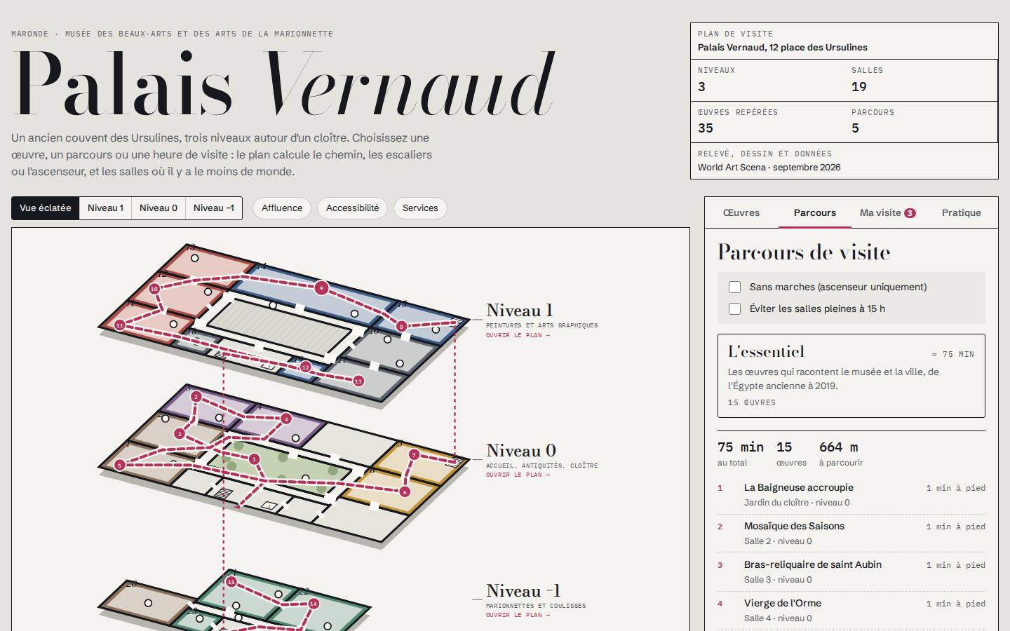
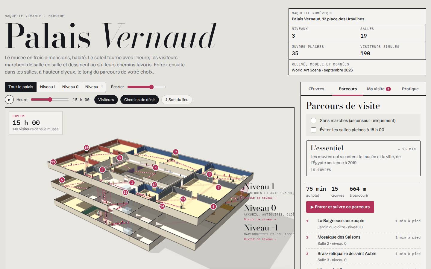
Palais Vernaud

The interactive plan of a three-level museum: visitor routes, highlighted works, hour-by-hour crowd levels and step-free routes.

  • Exploded view of the floors
  • Computed routes
  • Crowd levels and accessibility
Open the demo
N° 03
Festival · map and programme

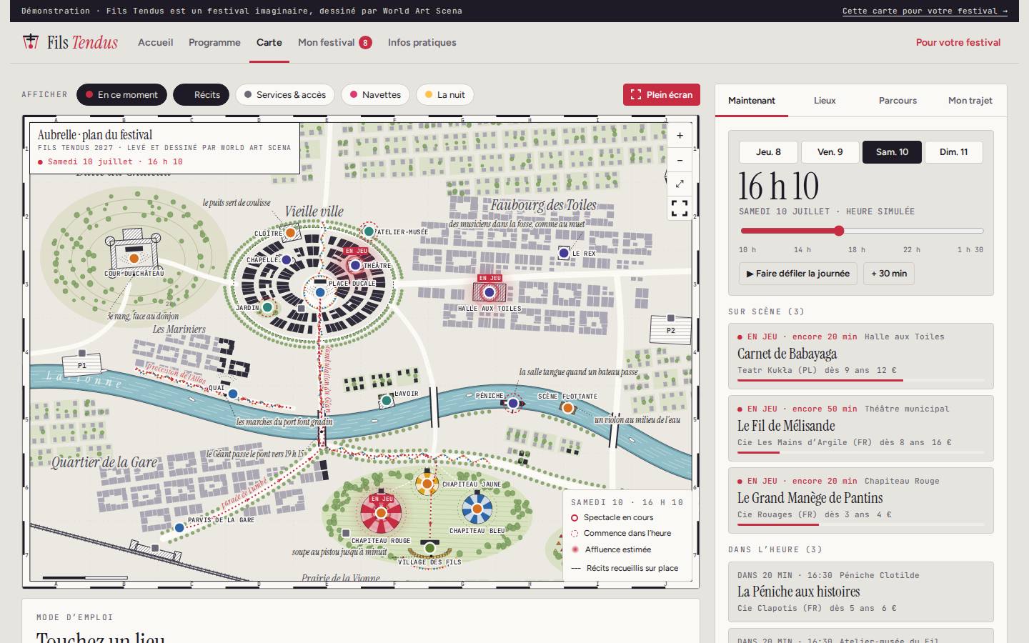
Fils Tendus

A puppetry festival website: programme linked to the map, what is on right now, personal programme with walking times.

  • “Right now” map
  • Personal programme
  • Shuttles, services, night mode
Open the demo
N° 04
Territory · atlas and directory

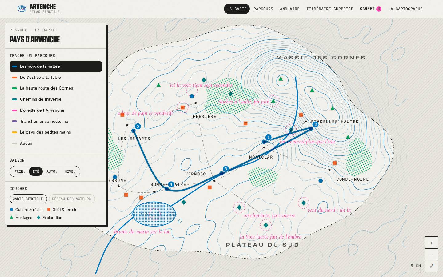
Atlas de l’Arvenche

The sensory atlas of a valley: a living directory of places and people, seven routes, one map per season and a surprise itinerary.

  • Directory of recommendations
  • Routes with elevation profile
  • One map per season
Open the demo
N° 05
City · sensory map

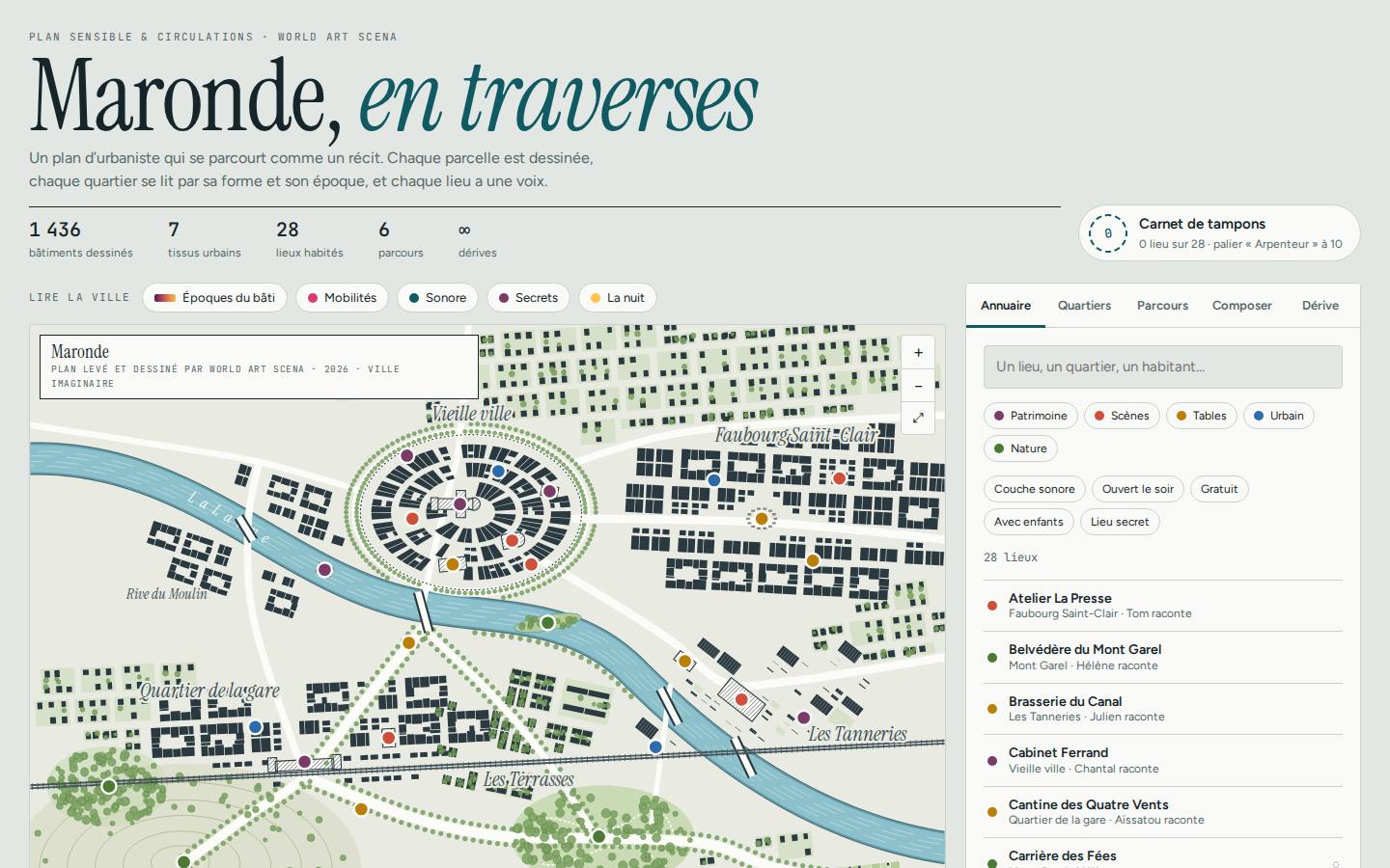
Maronde en traverses

The map of a city read through its districts, its eras and its voices: directory, routes, custom walk, drift and stamp book.

  • Building eras
  • Custom walk
  • Stamp book
Open the demo

Our demos use fictional places, people and stories: our clients' data and their audiences' data are never published without their permission. The demos are in French; your map can be delivered in all five languages of this site.

The problem

Artworks are accessible. They are not discoverable.

Platforms organise visibility around views, clicks and followers. The rare, the emerging and the demanding become noise. We do the opposite: maps that show what truly exists in a territory, and the connections that bring it to life.

1.12 M
living artists already listed in open data, across all disciplines
5
possible languages for every map: French, English, Spanish, Arabic, Chinese
100%
sourced entries and justified recommendations
2 AIs
explainable, designed in France, supervised by researchers

Who is it for?

Maps designed for the people who keep culture alive.

01

Local authorities

Show the cultural vitality of a town, a district or a region.

02

Tourism

Offer visitors cultural and heritage trails in several languages.

03

Festivals & seasons

Map artists, venues and audiences, and demonstrate your reach to funders.

04

Networks & federations

Make your members visible in a living map-based directory.

05

Venues & companies

Place your work in its ecosystem: partners, tours, territories.

Demo

The planet of puppetry arts.

Our first map connects puppetry festivals, centres, museums, schools and theatres on every continent. Spin the globe.

Explore the map

How it works

From your need to a map online.

01

Free first meeting

A no-obligation conversation about your territory, audiences and goals, followed by a free quote.

02

Research & collection

We gather and verify the data: venues, artists, works, events, sources.

03

Map design

Entries, thematic layers, trails, your visual identity, language versions.

04

Launch & follow-up

Integration into your website, training, dashboard and regular updates.

Do you have a territory to reveal?

Tell us about your project. We reply within 2 working days with a first proposal.

Request a quote